
Exploring the Eastern Sierra along Hwy 395
from Ridgecrest to Bridgeport.
.

This is the location of all the pictures I have taken over the past few decades.
I have lived in Ridgecrest since the early ‘80s. One of the great benefits of living here is exploring the Eastern Sierras and White Mountain Ranges, as well as the Panamint Valley to Death Valley. I intend not to make this a well-polished travel guide but rather just some notes and suggestions for anyone wanting a basic guide to the Eastern Sierras and surrounding area.
I would encourage you to explore early American and Native Indigenous history, everything from the old railroads and mining companies to hiking trails, hunting, fishing, or endless places to take great pictures if you're a shutterbug like me.
I have tried to include Hyperlinks (the underlined words)that will direct you to a Google Map, YouTube video, or other information. As I said, this is just a tiny portion. You could spend decades exploring all the canyons, creeks, back roads, and mountains along the Eastern Sierra Nevada Mountains.
90% of the places listed are accessible with two-wheel-drive vehicles. I will note places that require four-wheel drive or a car with good ground clearance.
I will also try to include a general area map, a hyperlink map for a more precise location, and pictures of the area listed.
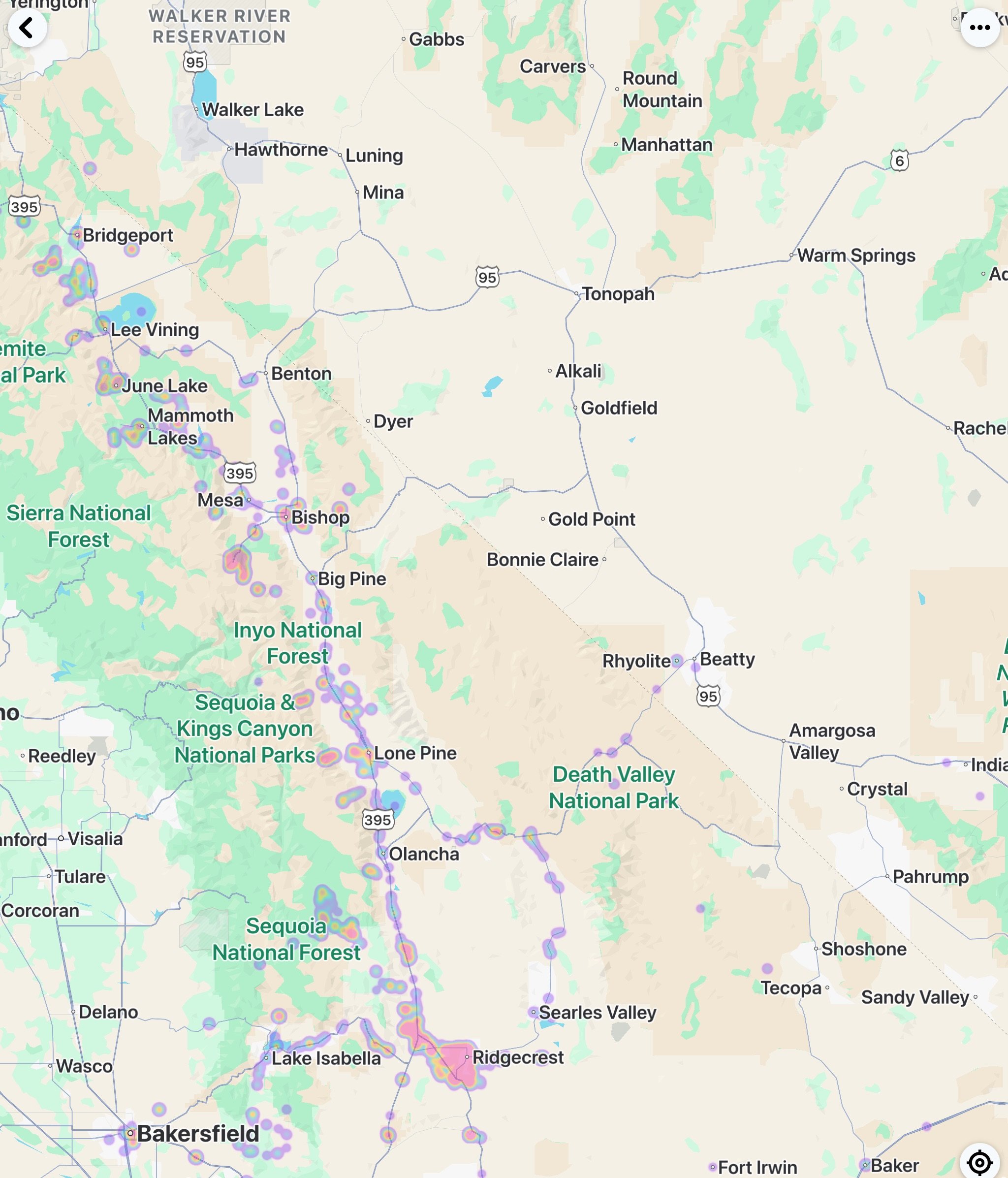
The Short Canyon Trailway is about 18 miles from the center of Ridgecrest. This road may be impassable due to recent rainfall or the accumulation of blowing sand. LADWP maintains the road leading up to Short Canyon and many dirt roads along the aqueduct and power line.
This is a great place to hike, especially when wildflowers bloom in the spring. A few places to park and hike are evident along the road leading up to the trail's end. Drive up and stay straight to the BLM-marked trailhead, where you’ll also have information signs. Head up the marked trail, and you choose how far you want to go.
Explore the small waterfall on the southern trail. Just drive back down and follow the canyon. The trail is a little tricky, depending on the time of year. Stay to the right, and you’ll find this little hidden gem. Springtime is best, as snow runoff will make for a better waterfall.

Springtime Wildflowers

Short Canyon Waterfall

Drive up to Short Canyon


Sand Canyon is another short trip from Ridgecrest, the same road type as Short Canyon. There are water crossings and streams to contend with. I recommend a high-clearance or four-wheel drive to the Sand Canyon Trailhead. Take Brown Rd. Heading west about 4,300 ft to the entrance of the gravel pit, just veer left Sand Canyon Rd. You come across your first water crossing and head up. You drive under the LADWP aqueduct pipe and go slowly, a few blind little turns. You’ll come to your next water crossing, and it is safe to drive through, depending on the water level. Then, you will come to the Sand Canyon Trailhead. You can park here and hit the trail walk through the wooden stanchions. You will also see a Visitor Sign with information about the area's local flora, fauna, and whatnot
SAND CANYON TRAIL HEAD
If you’re looking to get away from the summer heat of Ridgecrest, I recommend Kennedy Meadows or further up about 57 miles from Ridgecrest to Troy Meadows (amongst other campgrounds and meadows up here). Head north, just shy of 3 miles past Pearsonville, to 9 Mile Canyon Rd to Kennedy Meadows or Chimney Peak Campgrounds. Pearsonville if you require fuel and food. If not, keep going; there is not much in Pearsonville any longer. Years ago, there was a large junkyard, a little ‘ghost town,’ and an old racetrack, and it was the hubcap capital of the world.
Kennedy Meadows, or higher elevation, is only accessible from about May to October, and some years only from June to September, depending on how much snow falls during the winter months and if the roads are cleared. Snow will melt and leave a lot of debris behind. August is always a great time to head up, even over the mountains to Kernville. The road up Nine-Mile Canyon is very well maintained and a great place to go camping or just for the day for a picnic. There are only a few places to grab some food, so be sure to bring food and water just in case. But if you come up on a day, if they are open, try Grumpy Bears Retreat. They make great hamburgers and other food and grab ice-cold beverages as well. Five miles up the road, you’ll come to a fork in the road; stay to the right, and you’ll end up at the Kennedy Meadows Campground. To the left and by the intersection is the Kennedy Meadows General Store. Another great stop and great food. It's always a flip of the coin to decide between the two.
Head further up the mountain to Jackass Meadows, Fish Creek Campgrounds, and Troy Meadows. If you ride off-road vehicles (dirt bikes to ATVs), you can also use the trails up here. They must be equipped with spark arrestors. Continuing up the mountain about 3 miles past Troy Meadows, you’ll to an intersection, go right to Black Rock Fire Station, which will end 8.2 miles at the Black Rock Trailhead. Before that, there is a turn-off to Powell Meadow with some great views (if you don’t have an off-road vehicle, turn back once you run out of pavement).

Powell Meadows


Double Cheeseburger at Grumpy Bears


About 30 miles north of Ridgecrest, the Old Town of Little Lake, there was a hotel and small town here. The hotel burned down in 1989. Little Lake was the first water stop after trekking through the desert. All that remains here is the old Post Office building, and the road was torn up to keep people out. There is no fishing here, and it is a protected wetland and bird sanctuary, but it is a neat little site to check out.
You can also go around the lake to the top to a vista lookout above Little Lake.
To get to Little Lake Overlook, take Cinder Rd (link here). Instead of a right turn to Fossil Falls Trailhead, stay straight and go around Red Hill Cinder Cone. Then, veer right, heading southeast to Powerline Rd. Turn right, head south for close to three miles, and follow to the top of Little Lake Overlook.
The main attraction in the area north of Little Lake is Fossil Falls. Here, you can see where the Coso Indians once lived. To get here, make a right (east) on Cinder Road and follow the dirt road (most are paved until the last mile or so). You will come to a dead-end where the BLM has posted signs to read about Fossil Falls and restrooms.
You'll have to walk about 100 yards from the dead-end to the falls. Be careful when exploring the dried-up waterfall; it can be a 30-foot drop in some places. If you see anything in the summer months, go early in the morning. If hiking down to the bottoms, just stay on the right (west) side, and it is a relatively easy hike. There is no shade, and it is very hot in the summer.

54 Miles north of Ridgecrest is Haiwee (Hay-Wee) Reservoir. This was a site where, in 1865, the landowners were killed by an Indian attack. This was near the Owen Valley Indian War 1862-1863. As of 2005, it was closed to the public due to restrictions on water use in Los Angeles County, and there is nothing really to do there now due to this fact. Some ignore the signs and fish Haiwee. I'm just sharing a little bit of history about Owen’s Valley.
The next small town is Olancha, CA. There is not much here for fishing or camping, but before you come into Olancha, you can make a left (west) on Sage Flat Rd and head up the Olancha Pass Trailhead. Just follow the road up, and it will come to a dead end. You’ll see a BLM sign showing the trail.
When I enter Olancha, seeing the mighty Sierra Mtns on the west side, the vast Owens Valley to the east, and the Coso Mtn Range. My mood changes, and I feel like I am at home. As you travel north, you should see many cattle on the road's right (east) side. Olancha is also home to Crystal Geysers Water. Also, you can get gas, jerky, and drinks here. Update: As of 2025, this road is sadly no longer. Now, it has expanded to a four-lane road. Olancha will turn into a ghost town in the next few years.
If you turn off (right) off 395 to HWY 190, you will head to the backside (south and east side) of Owens Lake (mostly dry) and the Olancha Sand Dunes; you can continue down this road and will come to the intersection. Make a right on HWY 190, and you'll be heading to Darwin, Father Crowley Lookout (aka Star Wars Canyon), Panamint Springs, Death Valley, and Scotty's Castle (which has been closed since 2015).


If you make a left heading north on 136, you will see the old town and train depot of Keeler and the Cerro Gordo Silver Mine entrance. Check out Ghost Town Living for great videos about Cerro Gordo and surrounding areas. If you continue north on 136, you will end up in Lone Pine.
On the way north, heading towards Lone Pine, you will see what is left of a very large lake, Owens Lake. In the 1920s, the lake was over 200 square miles and 200 feet deep. It is a primarily dry lakebed due to water from DWP being diverted to Los Angeles in the early 1920's. There are old docks that are still on the "shore" line. It makes Borax and Pot Ash; the lake is flooded and evaporated to let the minerals crystallize on the surface. You will see old buildings from the 1960s as they were when they finally closed. Also, if you took HWY 190 towards Death Valley, you would run into Highway 136 North, which will take you to the east side of the dry Owens Lake to the small town of Keeler, the town that was the entrance to the Cerro Gordo Silver Mines, which has been a Ghost town since the 1960s. If you stay on HWY 136 North, you will end up in Lone Pine, or just staying on HWY 395 North will get you to the same spot. If you make a right at the fork off 136/190, you will go towards Darwin, Panamint Springs /Valley, and then to Death Valley. Along that way, stop at Father Crowley Lookout, AKA Star Wars Canyon.
Heading north on 395, about 13 miles south of Lone Pine, check out the Cottonwood Creek Charcoal Kilns. A little more history of Owens Lake: the charcoal produced here was shipped across the lake for use in the Cerro Gordo Silver Mine.


A little over an hour or 80 miles north of Ridgecrest is the small town of Lone Pine, where you can spend a couple of days or weeks exploring the area. Warning, please, and thank you: When entering Lone Pine (and any of the small towns along 395), watch your speed and see what is posted. There are many pedestrians, crosswalks, animals, and cyclists along 395 going through these small towns, and the speed limit is 25 MPH through most of the cities.
I recommend going to the Lone Pine Ranger Station (Eastern Sierra Interagency Visitor Center) If you plan to get a fire permit, camping, bear food cans, or hiking permit (some hiking areas require a permit). Check out the Inyo National Forest Page if you plan to go fishing or hiking. This hyperlink will show you all the places to fish in Inyo County.
Check out the Lone Pine Film History Museum on the left (west) side of the road right before, south of McDonalds. Going to the museum before seeing the surrounding areas will help you appreciate all you will see—traveling west of Whitney Portal Rd. Make a left heading south on Tuttle Creek Rd. Watch your speed; there are a few blind turns and very narrow roads. Use the turnouts to park and explore or let others pass you. You will end up at Horseshoe Meadows Rd. Turn right and back north to Whitney Portal Rd. Make a left and head up the mountain to Mt. Whitney Portals. Depending on the time of the year, parking can be tough. There, you can check out the Whitney Portal Store, the always beautiful waterfall, and a fishing pond, or go for a small hike in the Jeffrey Pines (as silly as it may sound, take a sniff of a Jeffrey Pine; they smell like vanilla and butterscotch) and Sequoias. Whitney Portals is the launching-off place for those hiking up to Mt. Whitney, the highest mountain in the Continental U.S. If you are interested in making the hike to Mt. Whitney, inform yourself of what is needed prior.
Heading down the mountain, enter Movie Rd. and explore the other various rock formations that have been the backdrop for many movies, music videos, photos, and commercials. The road is all dirt and easily accessible by two-wheel-drive cars, but your car will get dirty. Park at the Mobius Arch trailhead, take a small hike to the Mobius Arch and make the loop to the Heart Arch, which is back to where you parked. There are also restrooms near the Mobius Arch Trailhead.
There are plenty of campgrounds and nearby RV parks for overnight stays. Reservations are needed for many campgrounds up and down the Eastern Sierras.
Another great place to check out is Cottonwood Campgrounds. If you wish to get to the Golden Trout up at the higher-elevation lakes, this adventure is for more advanced or expert hikers. You'll take Horseshoe Meadow Road (left) off Whitney Portals Rd and head to the campgrounds. You must also have a permit if you wish to overnight camp here. I have never camped in this area but enjoy going there.


OLD HAND-DRAWN MAP OF ALABAMA HILLS
AND A MAP OF MOVIE ROAD.


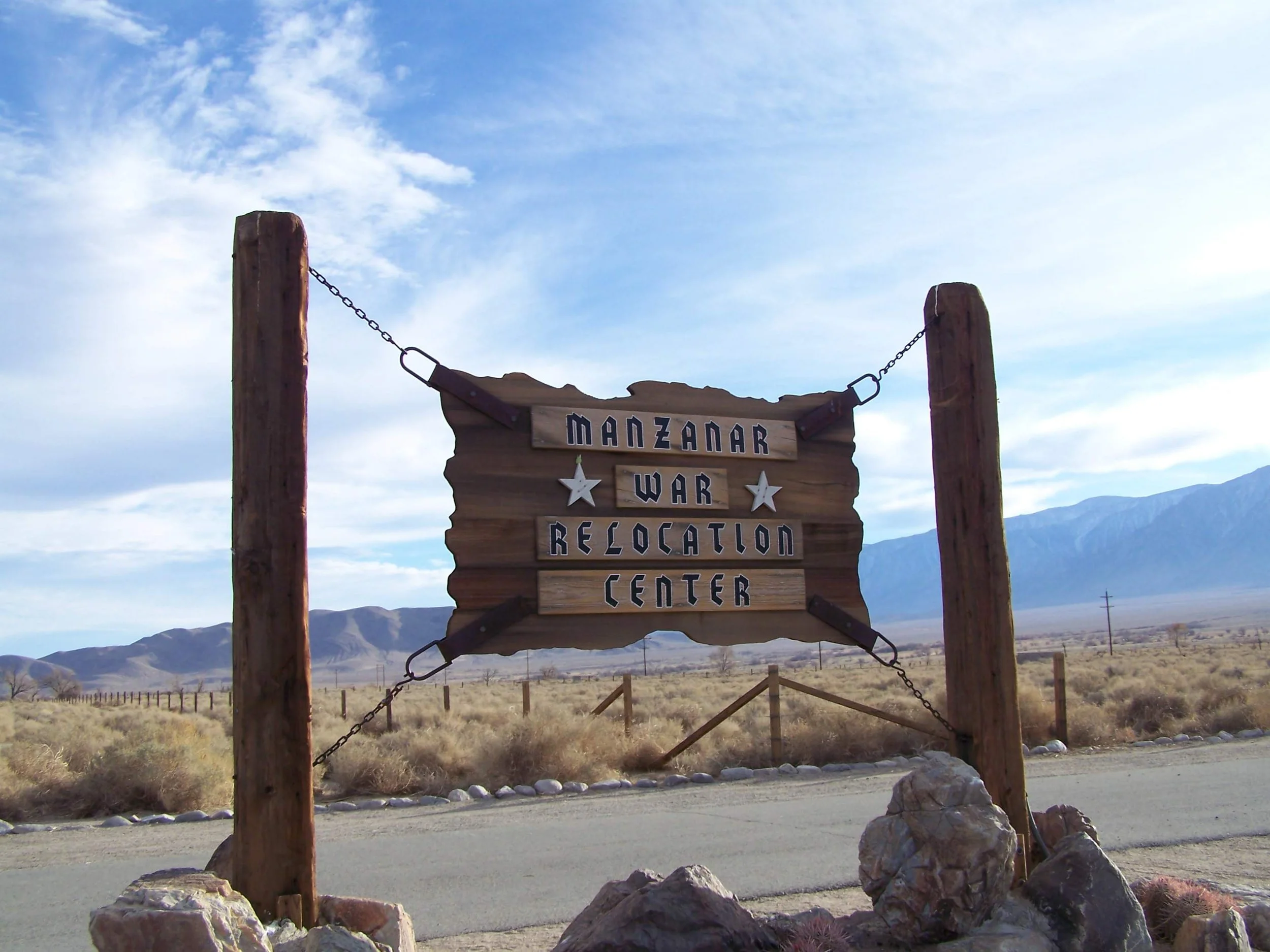
Manzanar Internment Camp is heading north on 395, just a few minutes from Lone Pine. This is where over 12,000 Japanese were interned here during WWII. 10 internment camps detained over 100,000 Japanese U.S. Citizens.
I believe this is a must-stop for anyone; it is very educational and enlightening, to say the least. You can go inside and explore or drive the compound to see the entire camp.
This is a free National Park and worth the stop.


A few miles north on HWY 395 takes you to the small town of Independence. One of the first things you will see on the right-hand side (east) is the Inyo County Courthouse. You can camp at the Gray Meadows (Upper and Lower) Campgrounds or Onion Valley Campgrounds; once again, reservations are required. Note Onion Valley Campgrounds are not accessible during the winter months and, depending on snow accumulation, could be from late May to early June.
Just a few miles north are the Mt Whitney Fish Hatchery. Kids love to feed the trout that is in the pond. A few "gumball" type machines are filled with feed, .25¢ and get a handful of fish feed. Toss it out there and watch the feeding frenzy begin. Note that the hatchery has gone through many changes over the years. The loss of part of the hatchery was mainly due to a flood. Also, COVID shut down the inside tours and feeding of the fish. The main building has been closed, but you can still see the trout in the main pond.
Most of the area north of Independence is Fort Independence Reservation Paiute Indian tribal land. This is why there is a small casino, usually with some of the better gas prices and other recreational accommodations. So please be mindful if you explore the area that you might be in tribal land. They are sovereign lands please be mindful and respectful of these facts.
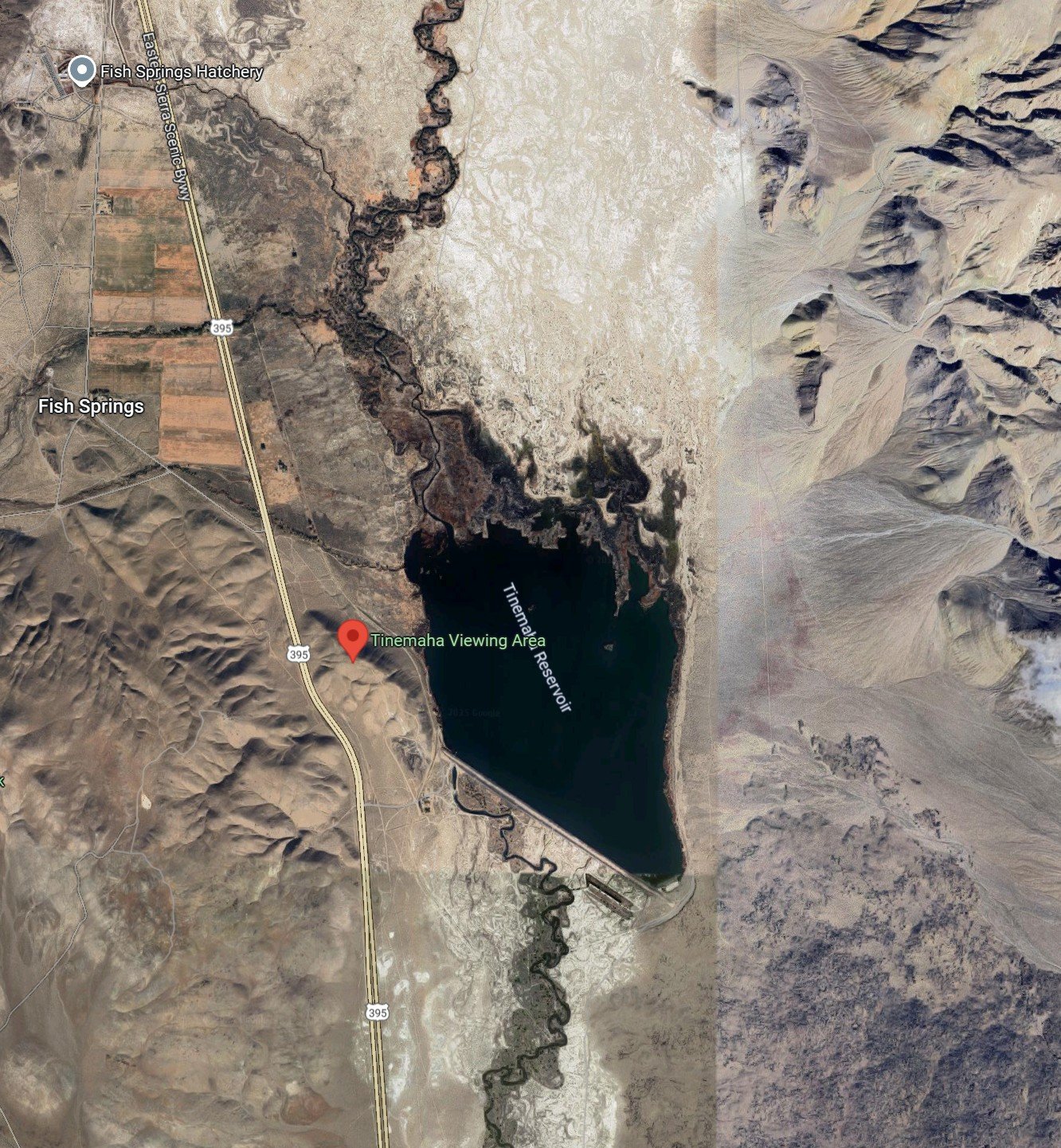
Between Independence and Big Pine is a man-made reservoir by the LA DWP. There is bass fishing as well as other fish. Also, lots of migrating birds are in the area. I would avoid it during the hotter summer days; it is too hot for me. But early opening season and fall are much nicer here. Fishing the Owens River is also an option if you don't mind walking. People canoe or kayak fish in the Owens River, starting from the north and heading downstream towards Lone Pine.


Big Pine is about two hours north of Ridgecrest and about 4,000ft. Points of Interest around Big Pine would be the Bristlecone Forest to the northeast, heading east on the 168, and the seven lakes and Palisades Glacier to the west.
To get to Big Pine Creek Trailhead, take a left at Glacier Lodge Road (W. Crocker Road, the turn-off for the road is between two gas stations) and head up until you get to the trailhead. You can make a small hike or go as far as you'd like, but bring water, and once again, you are at a higher elevation. I use small, weightless oxygen canisters to aid in the altitude. The trail will lead up to the lakes, which are turquoise in color. If you are still up to it, keep hiking to Sam Mack Meadow; I have never reached the Glacier, just the lower lakes.
Check out Inyo National Forest for more information.
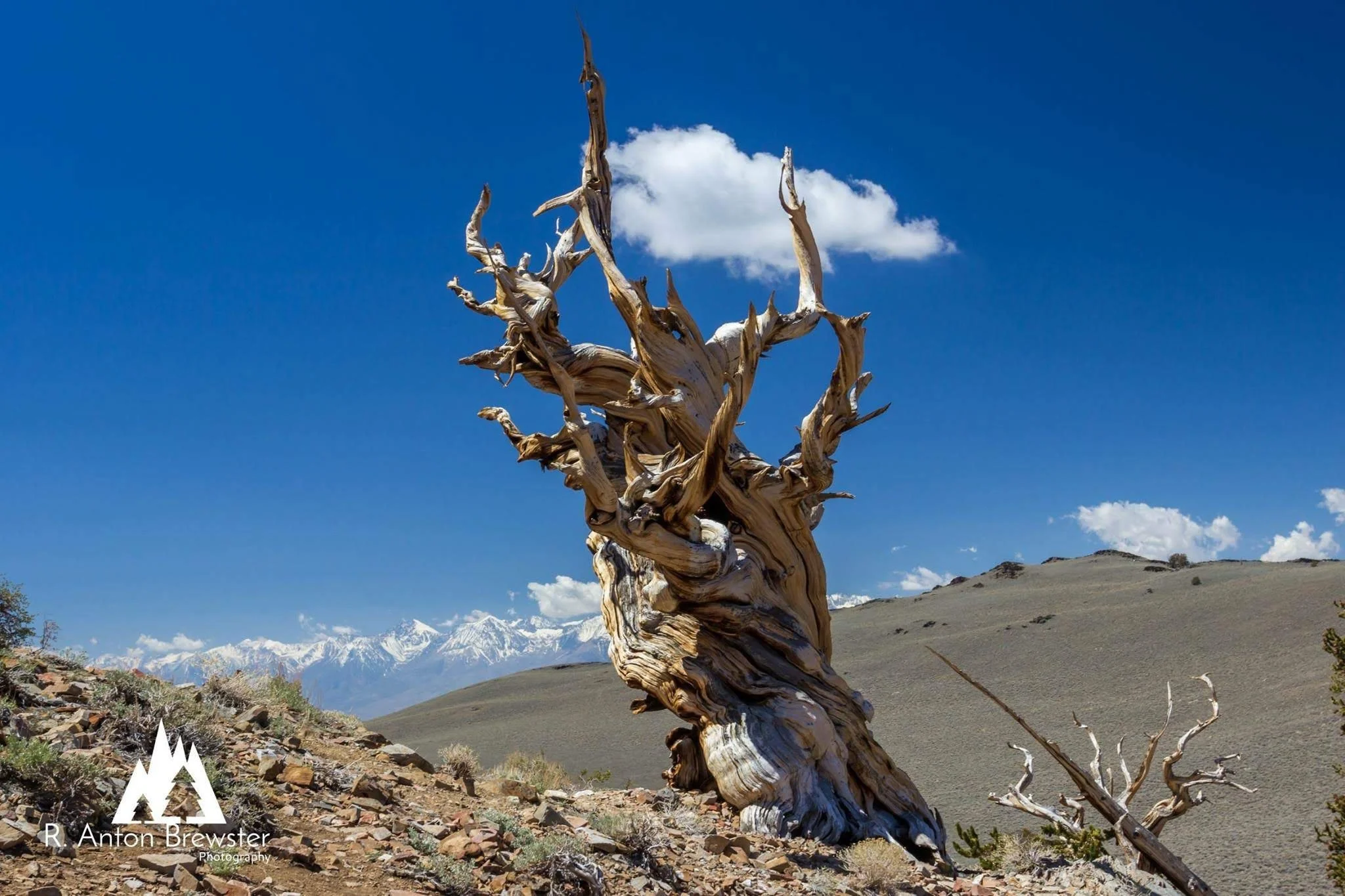
To see the Bristlecone Forest, make a right to HWY 168. Be careful. There are a few blind turns and narrow roads, but it is a good road to travel on; take your time, it is curvy. You can drive up to the visitor center at the end of the road. There are two trailheads you can take from here. One is 1 mile (½ mile up ½ mile down), and the other trail is close to 4 miles. The one mile is straightforward; the tree pictured here is on the trail once you descend. The trails are marked very well.
These trees are some of the oldest living things on earth, and if not the oldest, they are a must-see for anyone traveling up to 395.
The entrances to both places are only an hour’s drive from each other. Plan the whole day for the Palisade Glacier/Seven Lakes hike—1/2 day for the Bristlecone, with many signs and history to see at this location.
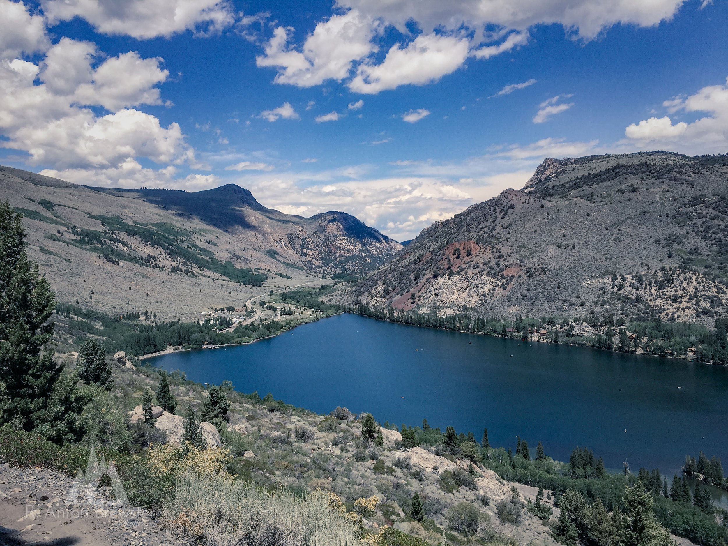
Klondike Lake is also near Big Pine, just a couple of miles north of Big Pine. It is mainly used for recreation, not much for fishing.


I recommend checking out the city of Bishop’s web page, Bishop, CA
There are too many things to say about this area. I will try to narrow it down to the highlights, and hopefully, you will make many trips to the area.
Keough Hot Springs on the west side, a few miles south of Bishop. I think everyone should check this place out at least once. It's a little off the beaten path, and if you don't mind jumping into a hot spring with a bunch of strangers, well, give it a go.
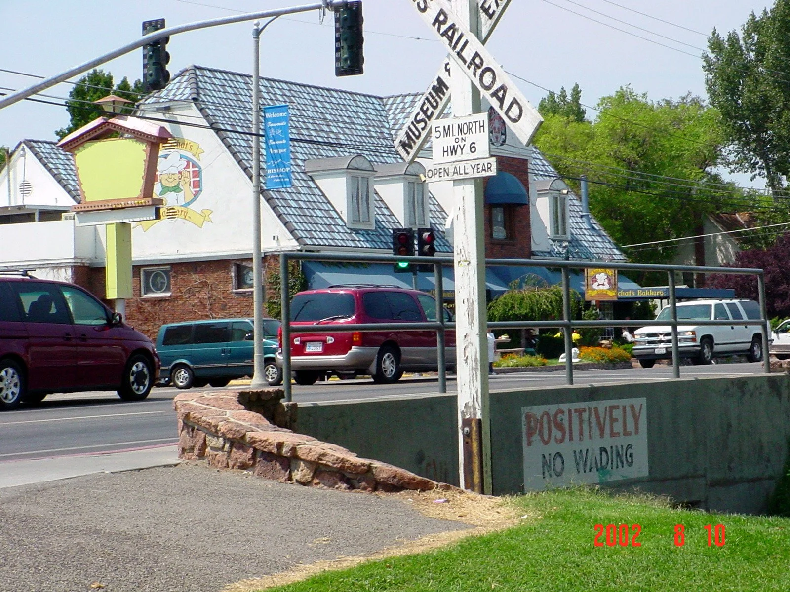
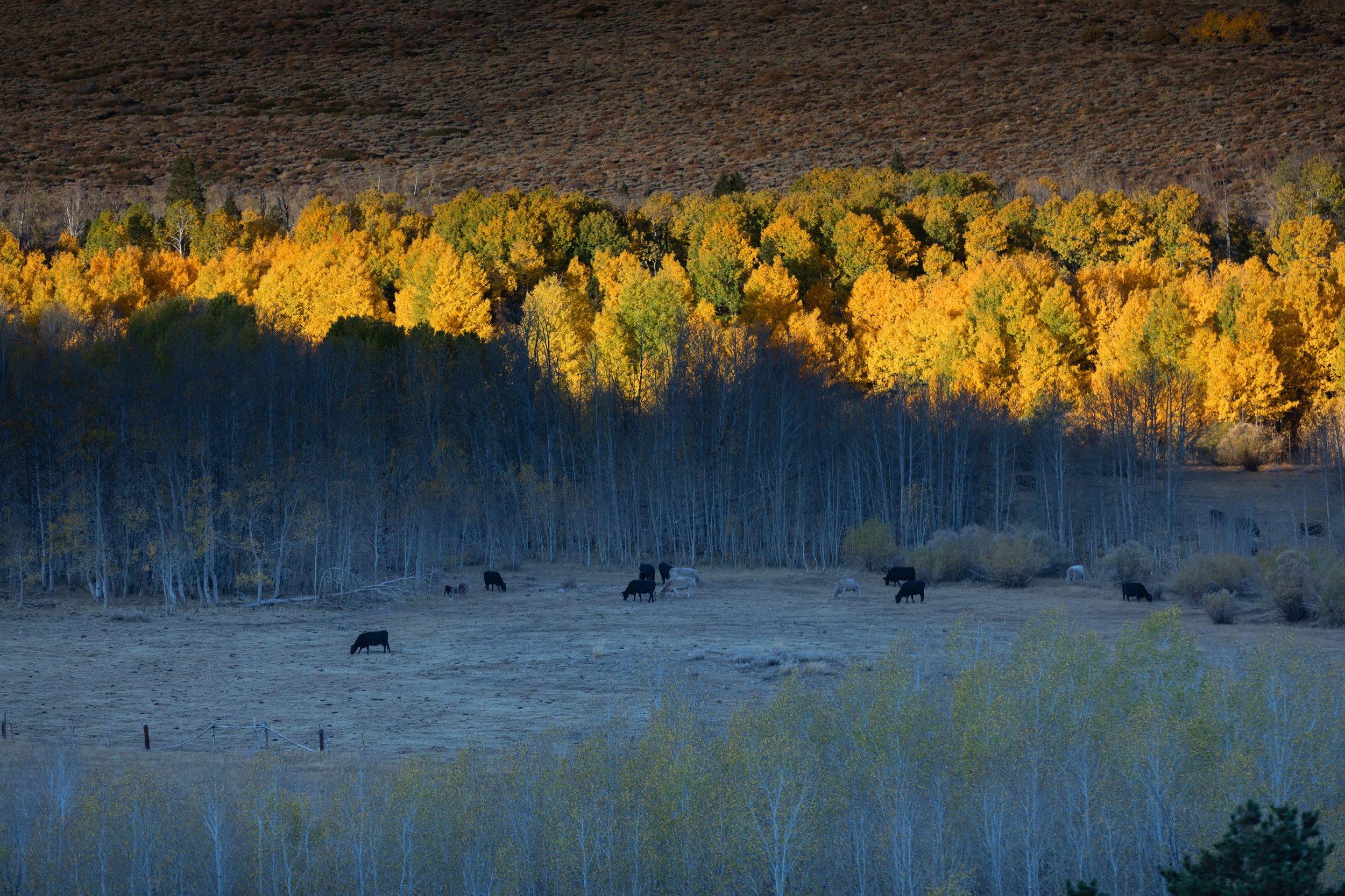
Continuing north on 395, about 2 hours from Ridgecrest, you'll come to one of my favorite small towns, Bishop. I could write a book about the area but will try to keep the region’s highlights. I come up for a bite to eat, relax at the park, or head to the mountains. If you are checking out Bishop for the day, I would recommend parking at the park. The park is in the middle of town on your right, across the street from the best bakery in the world, Schat's Bakery, in my humble opinion. Park at the city park, walk across the street to Schat's, and grab a sandwich (most of the time, there is a line, but it's worth it). On the left side of the building are fresh bread and sandwiches, and on the right side is the sweet side. My favorite sandwich is the Mule Kick, perfect every time. Take your lunch and sweets and head to the park to relax in the shade. There is a pond in the middle of the park, a skate park, and a swimming pool. After lunch, you can walk Main St (395) to the various shops. The Tri-County Fairgrounds holds concerts and annual events like Mule Days, Rodeos, and Tri-County Fair. Also, grab some excellent beef jerky or other meats at Mahogany Smoked Meats. Bishop is a great hub if you want a hotel room and check out places here or to the north. Check out Bishop’s Take W. Line Road (HWY 168) from the middle of Bishop. There is lots of stuff to see and do up in the mountains above Bishop. There are lots of places to camp, fish, or hike. During the fall, the area is covered in gold, orange, and red as the Aspen Trees change color in the early Fall. The peak for fall colors (Fall Map) is from mid-September to the first couple weeks in October. The first windstorm will take most of the leaves and color with it. During the winter months, the lakes will freeze over, and some roads are closed during the winter. First is Bishop Creek Intake II, a great place to spend the day (maybe with the lunch you picked up at Schat's). Heading 168, you will visit the Aspendell near Bishop Creek Campgrounds and Cardinal Village Resort. You can rent a cabin and fish on the grounds in Cardinal Village. During the summer, the café is also open, and they make steaks or oven-fired pizza. Heading up 168 (the road is closed during winter), you will come to Lake Sabrina and then turn off to North Lake. The road is narrow in some spots in some spots, so please pay attention.
Lake Sabrina, most of the time, you can fish right off the dam, but in dryer years, you'll have to walk to the water. You can head to North Lake as well for more fishing spots. Heading down 168, make a right on S. Lake Rd (just short of a mile past Intake II heading down). You can check out Bishop Creek Lodge, another place to get a snack or a launching point for your fishing adventure. Heading further up S. Lake Rd, you will come to Parchers Resort, another place to rent a cabin. Heading further up, you will come to South Lake, along both HWY 168 and S. Lake Rd, with many places to park and fish along miles of creeks and streams. The views around this area are breathtaking throughout the year, but once again, the fall is just stunning, a must for any landscape photographer or shutterbug.
Turn left, heading north once again, and return to Bishop. You can take a short drive up HWY 6 to the Laws Railroad Museum. There is a lot of history here, and it is not too far away off HWY 395. Another stop just north of Bishop is Chidago Petroglyph Canyon and Red Canyon Petroglyph.
If you continue north on Hwy 6, you can check out Benton Hot Springs and cut across Hwy 120 to 395 Owens Lake at the Grave of the Unknown Prospector. It is a beautiful hour-and-a-half drive, and you’ll spend hours just stopping along the way and enjoying the scenery. Also, there are campgrounds at Sagehen before getting to Owens Lake Area.
While in Bishop, if you wish to gamble a bit, check out Wanaaha Casino.
On more than a few occasions, I will stay at a local hotel in Bishop and use it as a hub to explore the Eastern Sierras from there.

Another 6 miles north of Bishop is Pleasant Valley Owens River Campground and Pleasant Valley Reservoir. This dry campground has no shade, but if you’re looking for an open area and place to fish, this might be the stop.
Heading north, you will climb in elevation. Road conditions can change very quickly from this point on. Winter conditions may require chains from this area to proceed north.
Another great stop is Tom's Place, 2½ hours north of Ridgecrest or 24 miles north of Bishop. Tom's Place is a hub for those wanting to check out the surrounding area, which has many creeks and fishing spots. You can rent a cabin here, gas, food, or whatever you need. Now, you can head up to Rock Creek Lake or the Rock Creek Lodge, where summer and winter accommodations exist. There are lots of fishing and hiking areas up here.
Lake Crowley is one of the larger lakes in the area, just north of Tom's Place on the right (east). You can bring your boat or kayak and fish the day away; they have boats, kayaks, cabins, and campground rentals. On the eastern shore of Lake Crowley is the Crowley Lake Stone Columns. You will need 4 Wheel Drive to access the columns, or you can park at the trailhead before the huge ditch and make the 1.8-mile, almost 4-mile round trip hike to the columns.
Convict Lake is a very picturesque location and has been the backdrop for many commercials and movies. Once again, cabin rentals, boats, and restaurants. Also, check out fishing in the Eastern Sierras.


The Mammoth Mountain website has more information than I could possibly write in a paragraph, so follow the link and get more information.
If you like hiking, mountain biking, backpacking, food, concerts, festivals, snow skiing or snowboarding, gondola rides (to 11,000 ft.), shopping, resorts, lodges, and to name a few things, there is always something to do year-round in Mammoth Mountain. Plan to spend a few bucks and a few days while at Mammoth.
If price may be an issue, I recommend staying in Bishop and using it as a hub. You can explore many of the areas a short drive from Bishop and still enjoy the area. Also, Google Maps is your friend when it comes to finding places to eat and things to see and do.


The June Lake Loop is about 20 miles north of Mammoth (loops around four lakes, June, Gull, Silver, and Grant lakes, back to HWY 395). Like Mammoth, there are things year around, usually less crowded and less touristy than Mammoth, but still a hot spot. The loop all the way around closes at the beginning of winter. Check out their webpage here: June Lake
I also recommend visiting in October, when the area has some of the most beautiful autumn colors.
Spend the day at June Lake Beach to relax and enjoy the man-made beach area. The water is cold, but it is enjoyable during the summer months. As of 2024, the park fee is $10.00. I also recommend getting there early because it can get a bit full, but it is still enjoyable even with the crowds.

Lee Vining is the next stop north on 395. If you take June Lake Loop from the south entrance, you'll end up further north on HWY 395. Head north, and you'll see Mono Lake. Mono Lake is a neat place to see at least once. Mono has no fish because the water is too alkaline for fish to live. There are brine shrimp and other wildlife there to see. It's also one of the oldest lakes in North America. Stop at the Mono Basin Scenic Area Visitor Center, which has a history of Mono Lake. Also nearby, the Upside-Down House is neat to check out at least once. Take a left turn up the 120 before Lee Vining, and there are three lakes (Ellery, Tioga Lake & Saddlebag) you can fish, also one of the highest roads in America. If you stay on the 120, you will enter the west side of the Sierra and Yosemite National Park. The 120 is closed during the winter months.

Prepare to climb approximately another 1700 feet higher in elevation. Conway Summit marks the highest point along U.S. HWY 395. At the bottom of the summit pass, Mono Lake is the turn-off for Lundy Lake. Then, you will climb a split highway to the top. At the top of the summit is the lookout and the turn-off for Virgina Lake.
These small lakes offer fishing, hiking, and other recreational activities. In the fall, I drive Dunderberg Meadow Rd to drive through the Aspen trees. Also, it is common to see the first snowfall in this area as early as September, so be prepared at this elevation for any weather at any time of the year.

Bridgeport is the next one along 395, heading north. It is a small town about 3½ hrs. north of Ridgecrest; of course, it always takes longer because of everything to stop and see. Fish the Bridgeport Reservoir, Twin Lakes (just about 12 miles to the southwest on Twin Lakes Rd from Bridgeport), or other streams. I usually find really good food here as well. I will try to stay at the Silver Maple Leaf Inn for a few days during the fall. It is another great hub from which to see the surrounding areas.
Check out the Bodie Ghost Town if you want to see something different.
